7.3 miles
Texas Department of Transportation
The proposed project is in southern Hardin County, west of Beaumont, TX. The proposed improvements start in Sour Lake, TX, at SH 326 and extend approximately 7.3 miles along SH 105 to Pine Island Bayou. Proposed improvements include converting the existing two-lane roadway into a four-lane divided roadway.
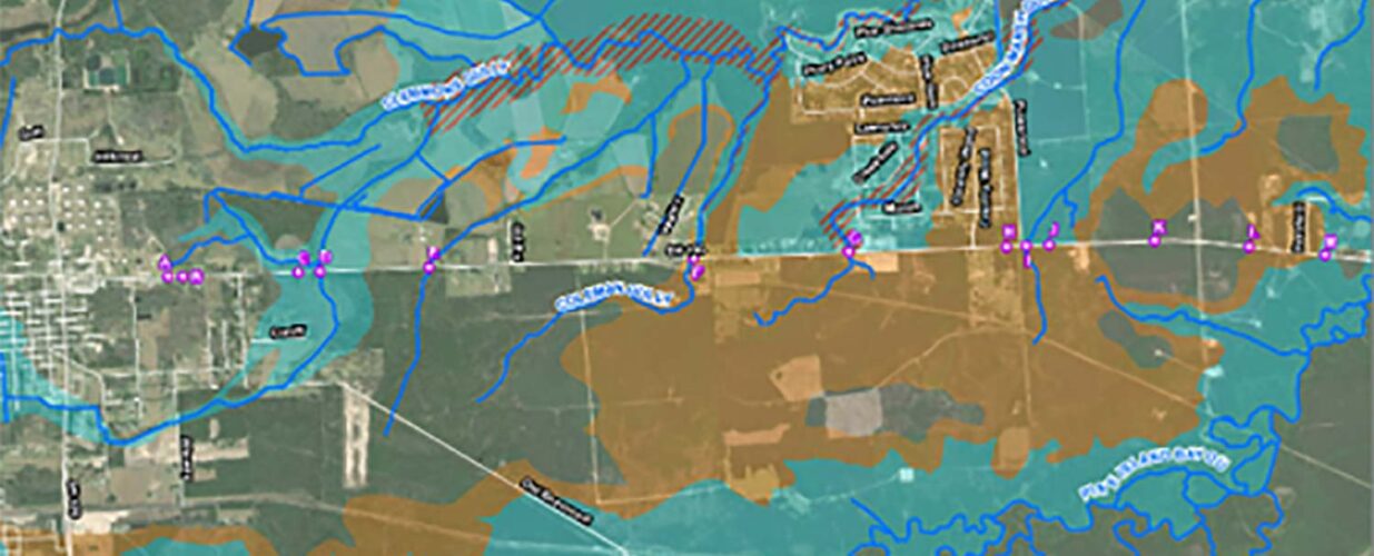
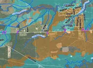
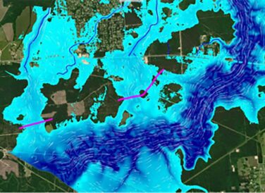
Along the project limits there are 13 cross drainage structures, 11 culverts and 2 bridge class culverts. Sixty-nine percent of the project was in shaded Zone X, Zone A, Zone AE or Floodway.
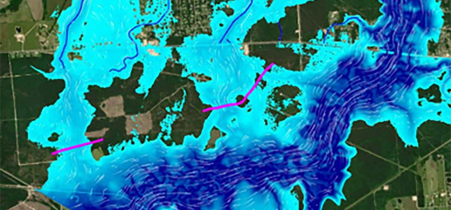
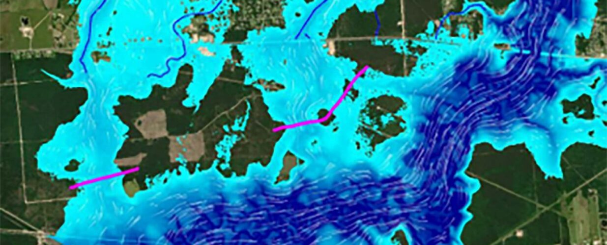
Halff developed b, d, & e Atlas 14 coefficients in advance of TxDOT releasing new IDF curves. The team proposed a roadway typical section and profile to not cause upstream impacts, due to changing the roadway profile. All the crossings were sized for the 25-year storm event to avoid inundating the roadway. Halff also performed a simplified 2D analysis, and determined that Pine Island Bayou spilled out of its banks and inundated the project location. Detailed 2D analysis was performed to determine the effects of the inundation and the required resizing.
Final proposed conditions included:
- 3 bridges
- 5 bridge class culverts
- 5 culverts
- 300 lf of channel clearing
- 1,800 lf of channel improvements
- 166,100 CY of Floodplain cut in 3 floodplain mitigation ponds to ensure no downstream adverse impacts with 141,500 CY of net cut in floodplain
Halff Services
Involved
- Environmental
- Flood Infrastructure Design
- Geospatial
- Geographic Information Systems
- SUE/Utility Coordination
- Surveying
- Transportation


Let’s Connect
Ready to work with Halff? Simply fill out the form to be directed to the best person at Halff to discuss your interests.