24 Acres
Private Energy Consultant
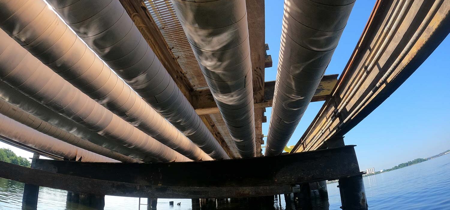
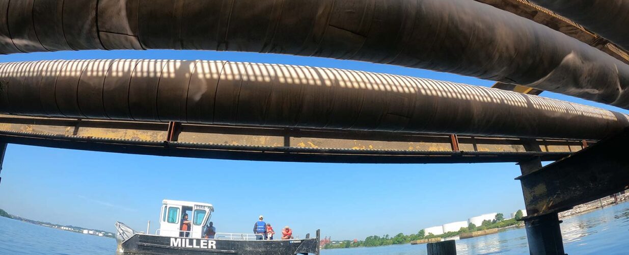
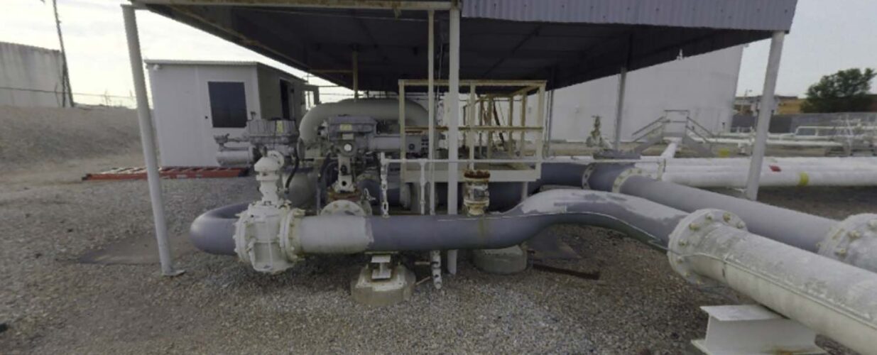
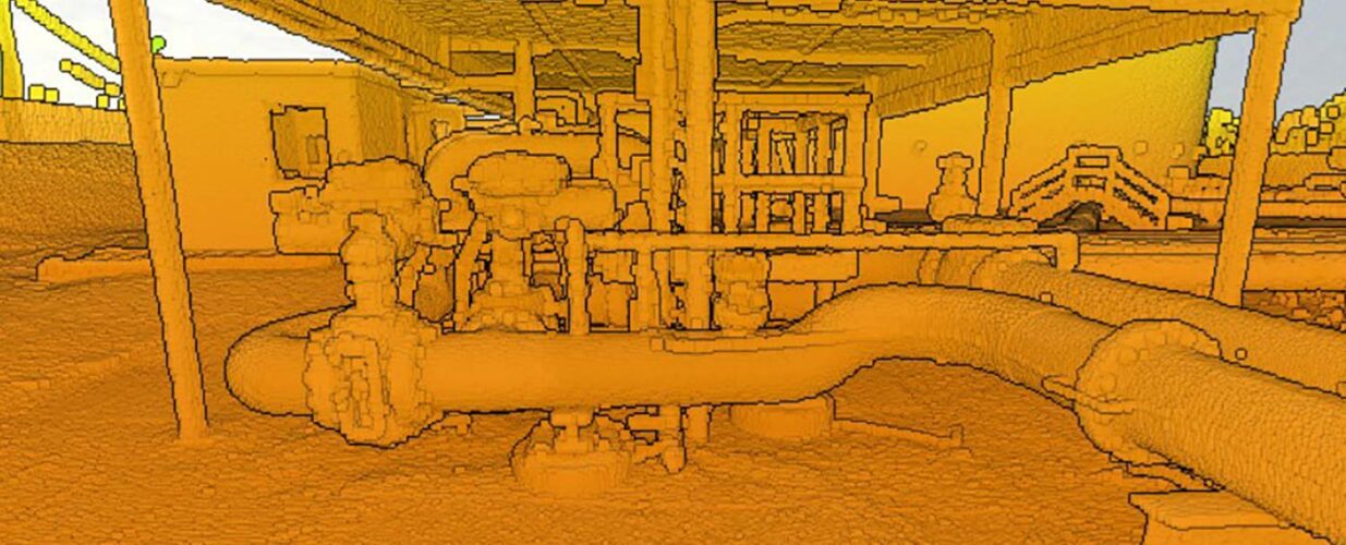
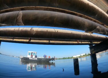
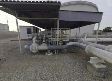
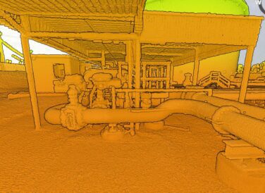
Halff provided a variety of geospatial and land surveying services for this energy project in Baltimore, Maryland. Data collection and analysis was critical along a 575-foot pier used as a dock for transfer station vessels off-loading their products. Data was collected under the pier utilizing a small, unmanned surface vehicle (USV) and a lidar sensor, which was custom mounted and typically used for aerial work. A handheld scanner was also used to collect data from otherwise inaccessible areas underneath the pier. Over 200 GoPro images were taken to document the condition of the pipework underneath the pier. Survey control was introduced to bring the data into real world coordinates. An approximately 24-acre refinery storage site adjacent to the pier was also scanned using terrestrial-based lidar for further analysis and inventory of the area.
Halff Services
Involved
- Geospatial
- Surveying


Let’s Connect
Ready to work with Halff? Simply fill out the form to be directed to the best person at Halff to discuss your interests.