Where? Surveyors Have the Answer
Land surveying is often a tale of the classic five W’s.
Who are we doing this for? The request may come from a title company, a consultant, an individual land owner or another stakeholder that we’re working with on a project.
What is the purpose of the survey? More than likely, a new design is in the works. Our engineering or architectural staff is looking to accomplish a client’s goal through survey.
When? Right away, of course. Surveys communicate the physical features of a property and the rights that go with it. Construction often can’t happen until this is determined.
Why? This is where our clients speak up. They are the ones who have a need and are approaching us—as a professional services firm—to help.
That brings us to the where part of the equation—the most important part of surveying. Surveyors provide information about where things are, such as boundary lines or physical features on the ground. They can also tell us where boundary lines or physical features are wanted in the future. Everything surveyors do boils down to the where.
They don’t tell us who owns what. They don’t tell us what the design of a building will look like. Surveyors, through a series of scientific measurements, paint a clear picture of what the conditions of a property are right now, so engineers and architects can engage and turn the current space into something the client ultimately wants.
Surveys can also show where improvements have been made to a property or where visible utilities are located.
Determining where boundary lines exist can be a difficult process, and it often requires a lot of research for surveyors. They look at deeds that have been recorded in different places, then go into the field and look for evidence described in those deeds. Generally, evidence found on the ground is going to hold true from where deeds say things might be. Deeds get surveyors close, they find new things along the way and make the two work together.
Essentially, surveyors are always verifying and retracing information believed to be true.
Types of Surveys
There are two primary types of surveys: topographic and boundary.
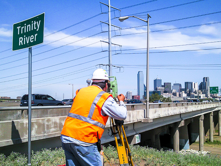
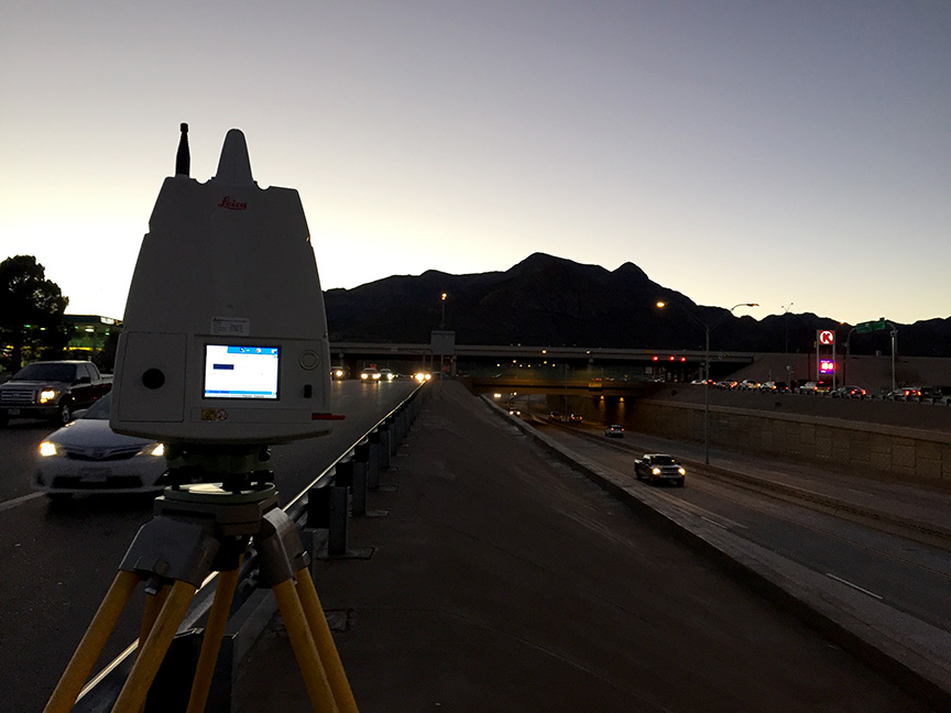
Topographic surveying involves gathering horizontal and vertical data necessary to prepare maps showing objects found on the site. They are physical things that anyone can go out and see.
Examples of topographic surveying include verifying public or private infrastructure, as-built drawings, cross sections and staking utilities (franchise or public); developing or maintaining a citywide control network; and conducting tree surveys.
Surveyors accurately locate where those things are and bring them into a digital space for consumption and analysis by others. Halff field crews, who are equipped with data collectors and iPads, use “field-to-finish” linework and feature codes to effectively draw a map of what they are surveying in real time.
Contours can be generated using a Digital Terrain Model, and final deliverables include traditional paper maps, PDFs, electronic CADD files, GIS files, ASCII files or any combination.
Boundary surveying identifies the correlation of legal records and field information to produce a map showing the property lines, land area, legal description and any conflicts that may affect title or expert witness cases.
Examples of deliverables in this broad category include right-of-way maps and descriptions, legal descriptions, as-built drawings that include accurate boundaries, franchise or public utility easement descriptions, platting, and staking rights-of-way, easements or property lines.
Office staff prepare deed sketches so field crews know what property monuments to look for and approximately where to find them. Registered Professional Land Surveyors (RPLS) will analyze the results of the field work versus what is called for in the deed records to determine the accurate location of any existing boundary or easement lines.
The result of any topographic or boundary survey will be an accurately defined answer to the “where” question.
For more information about surveying, write to Info-Surveying@Halff.com.
Recent Stories

Halff Receives ACEC Florida FDOT Outstanding Project Award
CRESTVIEW, Fla. — The SR 30 Pedestrian Underpass at the Inlet Beach project was presented with the Outstanding Project Award in…
How Resilience Planning Helps Communities Adapt and Strengthen
Resilience planning has become a critical focus in response to today’s unprecedented environmental challenges and billion-dollar climate disasters, which demand…