Regional Veloweb Connects Mobility to Quality of Life in North Texas
The Regional Veloweb, or more commonly Veloweb, may not be a widely recognizable name, but it is serious business when it comes to improving bicycle and pedestrian connectivity in the Dallas/Fort Worth Metroplex.
The result of a federal transportation bill signed into law in 1991, the Regional Veloweb formalized a planned 435-mile interconnected network of shared-use trails intended to interlink neighborhoods to shopping districts, jobs and even public transit. That vision was to better accommodate bicyclists, pedestrians, people with disabilities and yet-to-emerge alternatives to automobiles for active transportation.
That legislation set in motion a new 25-year framework for long-range mobility planning nationwide. The Regional Transportation Council (RTC) became our decision-maker for where to devote the use of federal transportation dollars in North Central Texas. The North Central Texas Council of Governments (NCTCOG) maintains and updates this regional mobility plan every five years.
Since the first 1997 Veloweb embodied in Mobility 2020, the region’s blueprint to accomplish transportation goals continues to grow. The 2020 plan, almost 25 years later, has led to construction of more than 455 miles of trails that are on the ground today. Each plan update has led to more miles of Veloweb trails being added, many of which are in a programming, design or construction stage. The Veloweb includes planned connections in 10 counties and 105 cities across North Central Texas.
![]()
This North Central Texas Council of Governments map shows the existing, funded and planned Veloweb trails in a 10-county area as of June 2018. (Click map to enlarge.)
Many of these trails utilize or will utilize abandoned railroad tracks and share utility corridors, creeks and greenways along the Trinity River’s three forks, which flow throughout the Metroplex. The greenbelts provide some of the greatest potential for connectivity, but they are often the most challenging when planning suitable alignments.
Veloweb trail alignments are sometimes refined drastically during the evaluation process. NCTCOG staff typically collaborates with local governments during this phase of infrastructure planning. Halff’s Planning and Landscape Architecture (PLA) professionals turn these trail refinements into more tangible, constructible designs.
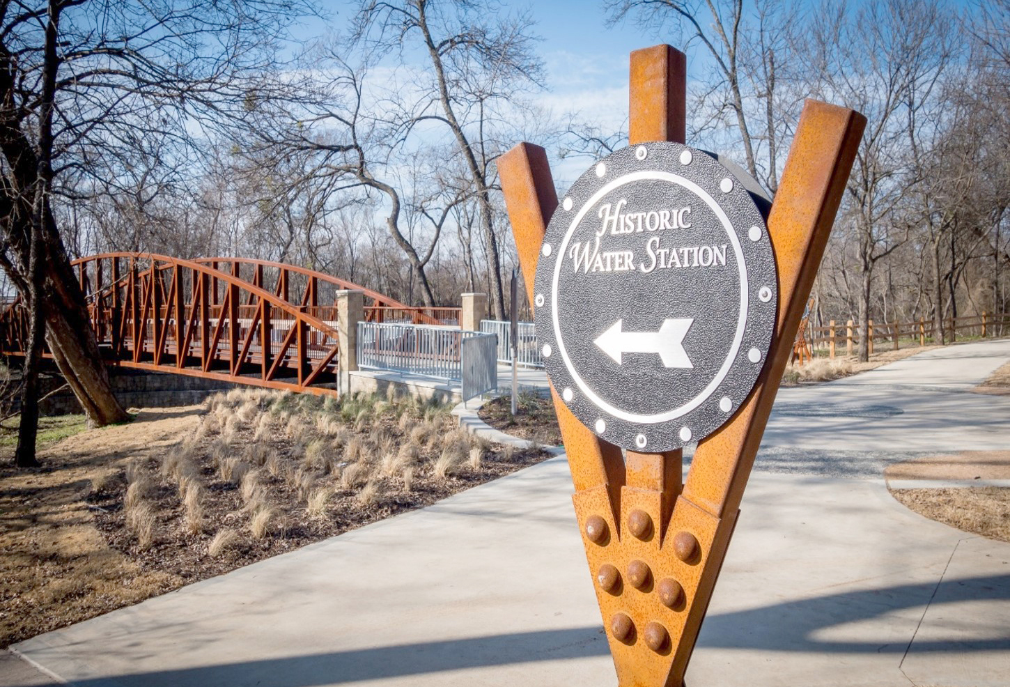
A trail that is aesthetically pleasing with multiple points of interest turns a bicyclist’s travel into a more enjoyable experience.
The Art and Science of Trail Design
Veloweb trail corridors often begin with little more than lines on paper maps. Halff’s professionals have cultivated an art and science in detailing our clients’ proposed Veloweb alignments. These learned talents and expertise—artistic and scientific—ensure the trail designs provide secure, comfortable and reliable access to destinations.
The science of trail design pertains to determining the constructible elements that may prevent trail construction such as flooding, slope or grade conflicts, soils, plant communities, sufficient right of way widths, property ownership or challenges around utilities or other types of infrastructure.
The art of trail design—or experiential aspects of these projects—addresses what users feel when they walk or bike along trail corridors. Do they feel safe and connected to points of ingress and egress? Is the space open or enclosed? How well is the corridor lit during non-daylight hours? Is the experience aesthetically pleasing?
Applying the art and science of trail design to all our civic-space projects ensures the best, most intuitive and sustainable solutions are eventually implemented.
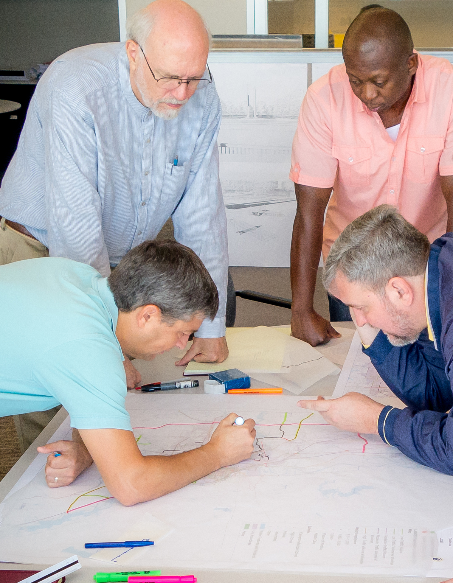
Halff’s Planning and Landscape Architecture professionals collaborate with in-house surveyors, subsurface utility engineers, water resources engineers and environmental experts to make refinements to planned trail alignments.
Execution With an Interdisciplinary Approach
A deeper dive into our process reveals how a regional trail master plan such as the Veloweb will work over time. Will refinements to the planned alignments enable it to be constructed as originally intended? That is where Halff’s in-house professionals use internal collaboration to ensure a client’s vision for a trail can be realized.
The process begins with mapping all the features of the proposed alignment, then conducting a visual assessment so potential hurdles can be overcome more easily. Development can occur quickly in many areas of the Metroplex—sometimes along valued creek corridors, where a visual inspection is instrumental to knowing what may have changed in recent years.
Halff’s surveying professionals assist with locating and identifying alignment boundaries, fences and other physical challenges such as utilities. Larger trees are typically tagged during survey for later identification of size and species by landscape architects. Subsurface utility engineering (SUE) professionals locate and identify utilities during a project’s planning or design phase to avoid costly conflicts and dangerous safety hazards.
Water resources professionals are often consulted to analyze flooding potential in low areas. This is critical to functionality and users’ reliability on the trail for transportation. This knowledge can also impact the maintenance of a trail corridor, once it is constructed. A heavily inundated trail, even in only one location, will hamper reliability and be more likely to accumulate silt over time, making the trail less usable and less safe.
Another layer to the mapping process may include delineation of wetlands. Halff’s environmental professionals provide better understandings of any impacts a trail plan may have on local wetlands or plant communities. Alignments may be modified to navigate around sensitive wetlands or elevated to pass over them on-structure.
![]()
More than 7,300 miles of combined Regional Veloweb trails, community paths and on-street bikeway networks are shown on this NCTCOG map.
A Call for Safe, Convenient Connections
The primary focus of the Regional Veloweb vision is to provide active transportation alternatives that help mitigate existing traffic congestion. As the Mobility 2045 plan states, “The United States Department of Transportation (USDOT) policy statement on Bicycle and Pedestrian Accommodation Regulations and Recommendations signed on March 11, 2010, is ‘to incorporate safe and convenient walking and bicycling facilities into transportation projects. Every transportation agency, including DOT, has the responsibility to improve conditions and opportunities for walking and bicycling and to integrate walking and bicycling into their transportation systems. Because of the numerous individual and community benefits that walking and bicycling provide—including health, safety, environmental, transportation and quality of life—transportation agencies are encouraged to go beyond minimum standards to provide safe and convenient facilities for these modes of travel.’ ”
The National Highway Traffic Safety Administration says 47 percent of Americans would like to see more bicycle facilities established in their communities. Over time, community interest in trails has evolved from development within fixed-park sites to expanding access to common destinations via enhanced streetscapes and linear trails.
At Halff, we improve lives and communities by turning ideas into reality. It’s our purpose. Our firm’s approach to designing the Regional Veloweb is only one of those special solutions that will continue to improve peoples’ lives for many years to come.


Halff has been working with cities and counties on funding and implementation of the Veloweb since the early 1990s. A current endeavor led by our Planning and Landscape Architecture practice is studying proposed alignments for the construction of shared-use paths between rail transit stations in Southeast Denton and Northwest Dallas County. As part of the Mobility 2045 Regional Veloweb, in an effort to reduce congestion and vehicle emissions by promoting the use of non-motorized travel, Halff is working to connect Denton County Transportation Authority (DCTA) and Dallas Area Rapid Transit (DART) passenger rail stations to paths located in each of the cities of Lewisville, Carrollton, Coppell and Dallas—a total distance of approximately 11 miles.
For more information, write to Halff’s Planning and Landscape Architecture team at Info-Landscape@Halff.com.
Recent Stories

Halff Receives ACEC Florida FDOT Outstanding Project Award
CRESTVIEW, Fla. — The SR 30 Pedestrian Underpass at the Inlet Beach project was presented with the Outstanding Project Award in…
How Resilience Planning Helps Communities Adapt and Strengthen
Resilience planning has become a critical focus in response to today’s unprecedented environmental challenges and billion-dollar climate disasters, which demand…