How LiDAR Contributes to the World Around Us
LiDAR is a lot like a five-tool baseball player. It is extremely versatile and excels at helping us accomplish greater things.
LiDAR is such a dynamic technology that it is used for an array of tasks such as floodplain modeling, urban planning, coastline management, conservation efforts, self-driving cars, and even gaming. For years, EA Sports has used LiDAR point clouds to create the most realistic three-dimensional environments possible for its video games. Xbox Kinect has used LiDAR technology to bring players into the games.
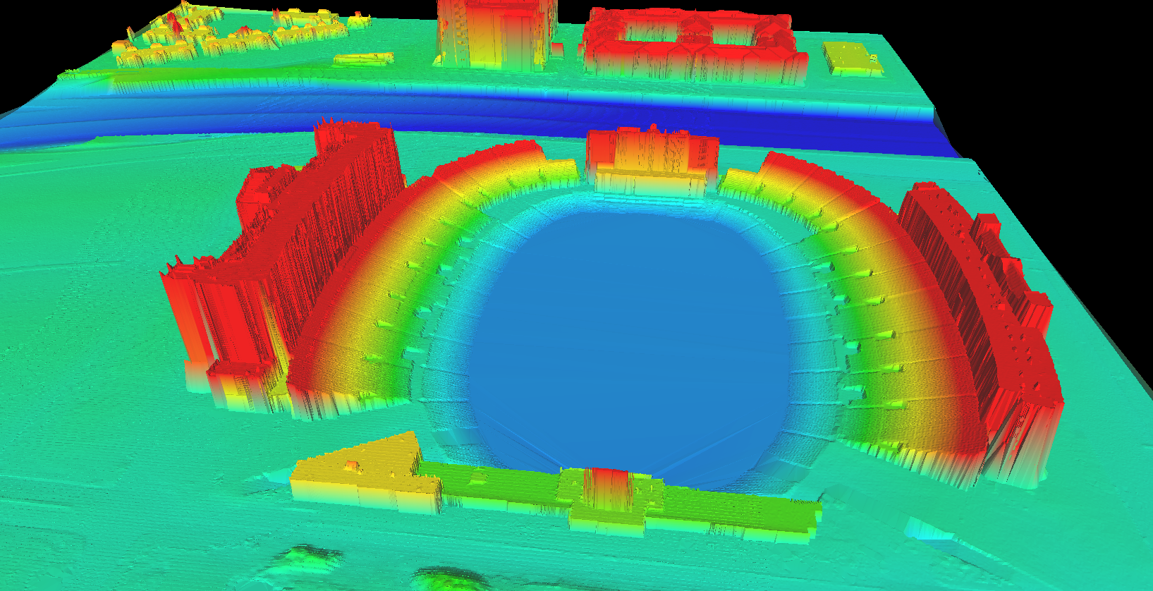
A LiDAR point cloud shows elevations of Jones AT&T Stadium at Texas Tech University.
LiDAR Basics
The LiDAR acronym stands for “Light Detection and Ranging.” This remote sensing technology uses light pulses to measure distances from a LiDAR unit to a surface. The resulting dataset is a dense point cloud representing the measurement—typically converted to elevation values—of each light pulse from the LiDAR unit. These points can be classified based on the type of surface they are reflected from, such as the ground, a building, or vegetation.
LiDAR units can be used in a variety of ways, depending on the surface data that need to be collected.
-
Terrestrial LiDAR: The unit is mounted on a stationary tripod and used to scan a specific location. This method is good for bridge inspections, utility plant sites, or indoor areas.
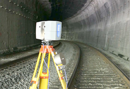
When combined with high-precision GPS units and inertial measuring units (IMUs), LiDAR can be collected as a continuous scan while in motion.
-
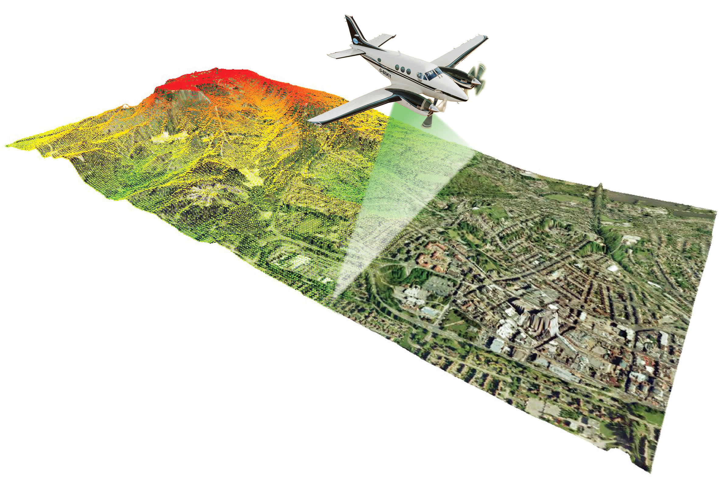
Aerial LiDAR: The unit is mounted on an aircraft such as an airplane, helicopter, or drone, allowing for LiDAR data to be collected for large areas. This is useful for topographic surfaces, vegetation mapping, and building extraction.
-
Mobile LiDAR: The unit is mounted on a vehicle such as a car, boat, or ATV so LiDAR data can be collected for corridor mapping. This method is ideal for streetscapes, shoreline inspections, and asset collection for urban environments.
Derivative Data Products
Now that you have all of that LiDAR data, let’s consider how it can be used.
Working with traditional aerial LiDAR can be challenging because of the sheer volume of data. Current LiDAR projects typically have a point density of about four points per square meter, which can lead to datasets containing millions, if not billions, of points. Halff uses Esri’s ArcGIS suite of desktop applications to view, process, and analyze LiDAR datasets.
Beyond simply viewing the surface depicted by the LiDAR point cloud, users can perform a variety of techniques to generate derivative products:
-
Using points classified as ground surface, traditional topographic contours can be generated.
-
Points classified as buildings can be used to develop 3D models of a downtown area.
-
Extracting all points classified as vegetation can provide tree density information and total canopy volume.
-
Creating a surface from the first returned points can provide a line of sight analysis or cell tower placement analysis.
Halff, which has been working with LiDAR data for almost 20 years, uses it extensively for floodplain mapping projects—using the data to map the contour of the land, and, ultimately, how water will flow over it to identify flood-risk areas. Halff has also used LiDAR to identify vegetation locations as part of levee inspection projects.
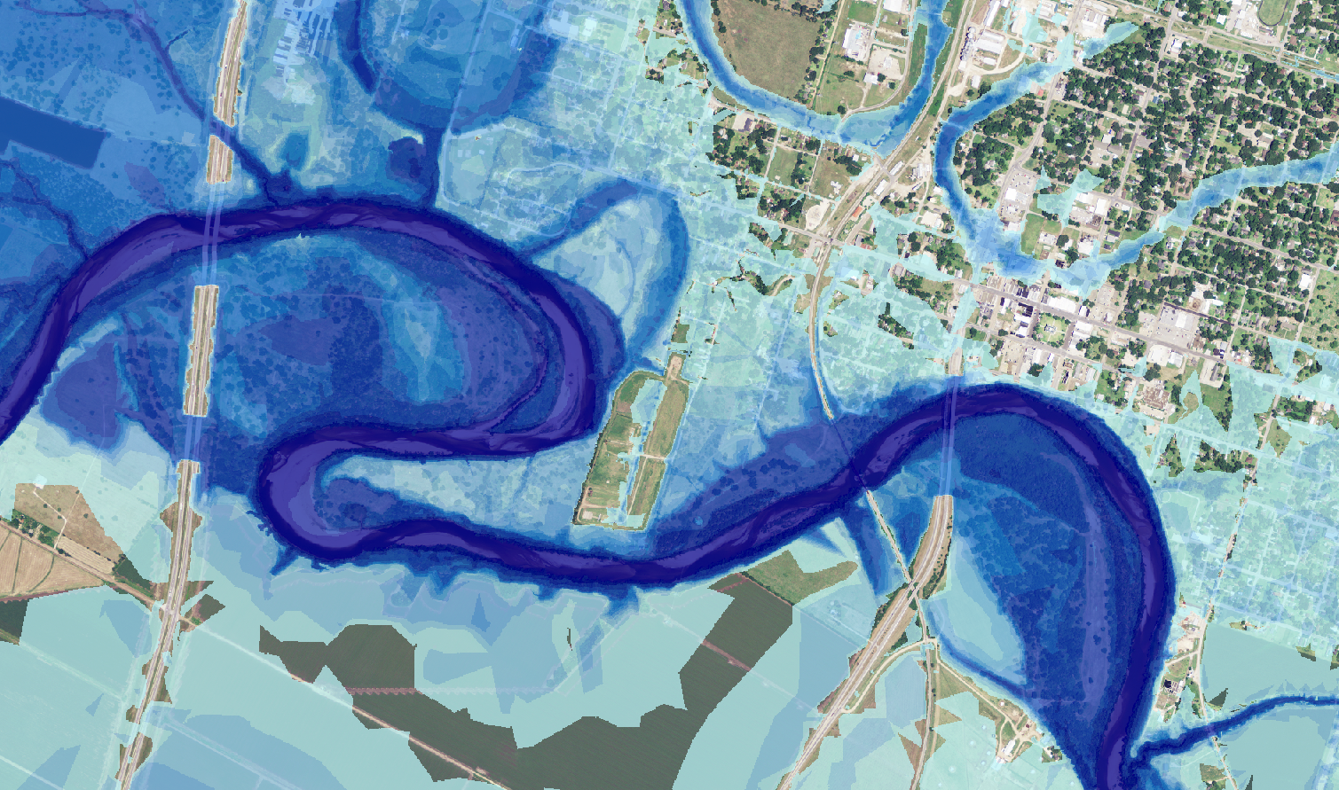
The image shows 2D floodplain mapping based on a LiDAR ground surface.
Large volumes of LiDAR data can be enhanced by integrating additional survey information and breaklines, and then converted to a variety of formats to support specific applications such as 2D hydraulic modeling, CAD design, and 3D visualization.
Extending LiDAR Capabilities
The 2017 Esri User Conference in July unveiled new tools to help users work with LiDAR data.
-
LiDAR data management tools help with optimizing, reprojecting, and reclassifying LAS files as well as converting the point clouds to other data formats.
-
New data extraction tools provide solutions for extracting vegetation canopy and crown properties, extruding 3D building footprints, and generating shadow models based on sun angle.
These new tools extend the existing capabilities of ArcGIS for working with LAS datasets and terrain datasets for surface analysis and generating derivative datasets.
Are you looking for more information about LiDAR? Write to Info-GIS@Halff.com.
Recent Stories

5 Halff Summer Spots to See in 2026
There are plenty of ways to “Halff” fun this summer! Immerse yourself in a handful of Halff’s recent projects that…

Case Study: The Project That Is Turning Stormwater Into Drinking Water for an Arid Region
A drainage district in Texas’ Deep South county of Hidalgo is employing innovative methods to convert stormwater into a steady…